How Beijing is closing surveillance gaps in the South China Sea
The discovery of a new radar system on China’s Triton Island military base shows that Beijing is rapidly developing its intelligence capacities in contested waters, write John Pollock and Damien Symon – Chatham House.
New satellite images reveal how the Chinese military is dramatically expanding its capabilities on Triton Island, which looks set to become a one of Beijing’s key signal intelligence bases in the South China Sea.
Once completed, the radar system would significantly increase China’s signals intercept and electronic warfare capabilities across the disputed Paracel Islands archipelago and add to a wider surveillance network spanning much of the South China Sea.
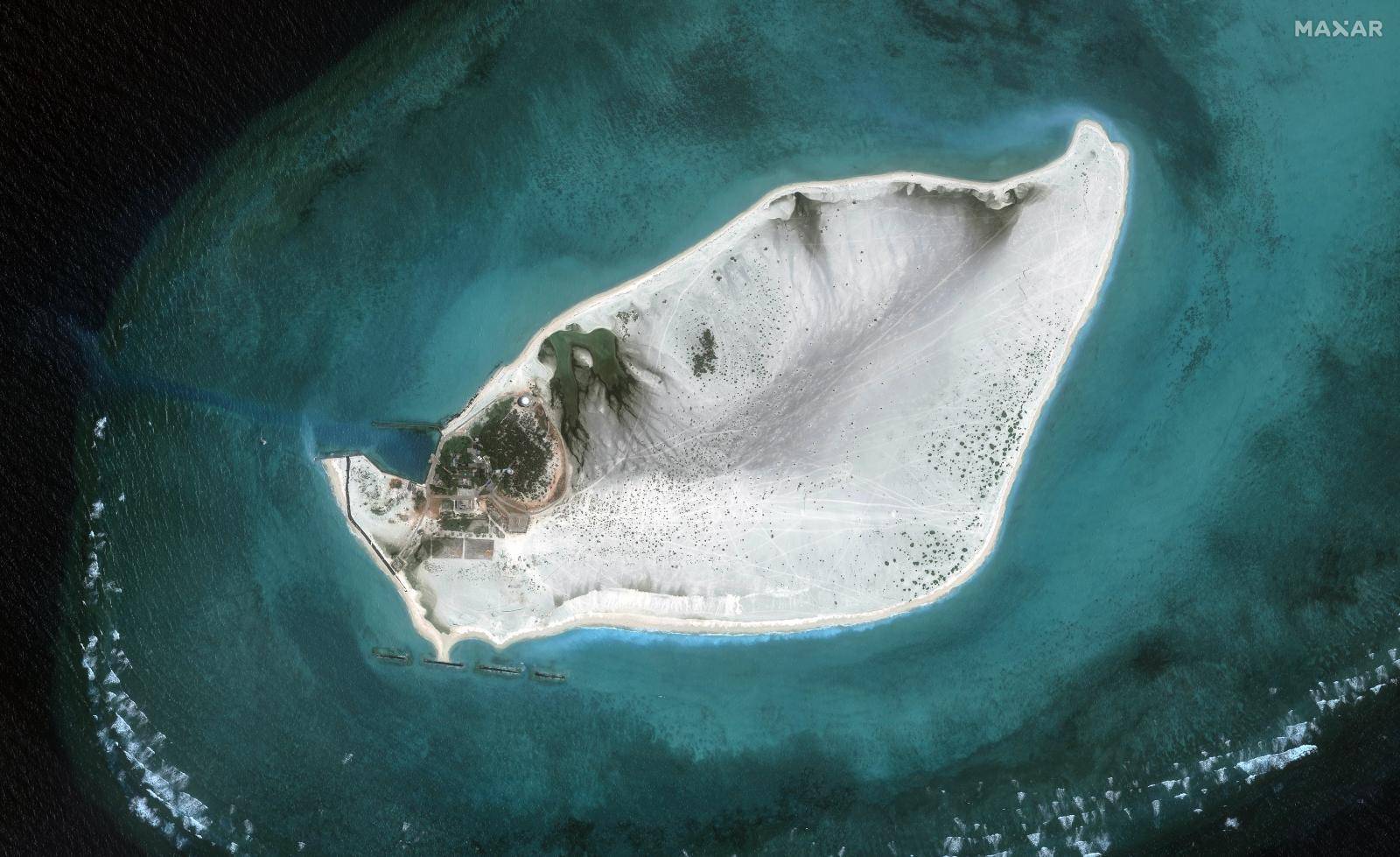

— Triton Island August 2022, top, and September 2024: Beijing has been upgrading the Triton outpost – known as Zhongjian Dao in China – with radar stations and other structures since 2015.
The enhanced facility on Triton is likely to offer a challenge to China’s competitors in the region and internationally.
China seized control of the Paracels from Vietnam in a 1974 naval battle, and competition for access to it waters has intensified since the recent discovery of oil and gas reserves. Chinese and Vietnamese maritime militia clashed off the coast of Triton in 2014.
In addition, American, British and Australian naval forces have for the past decade patrolled the waters to collectively challenge China’s contested ‘nine-dash-line’ claim to large stretches of the South China Sea.
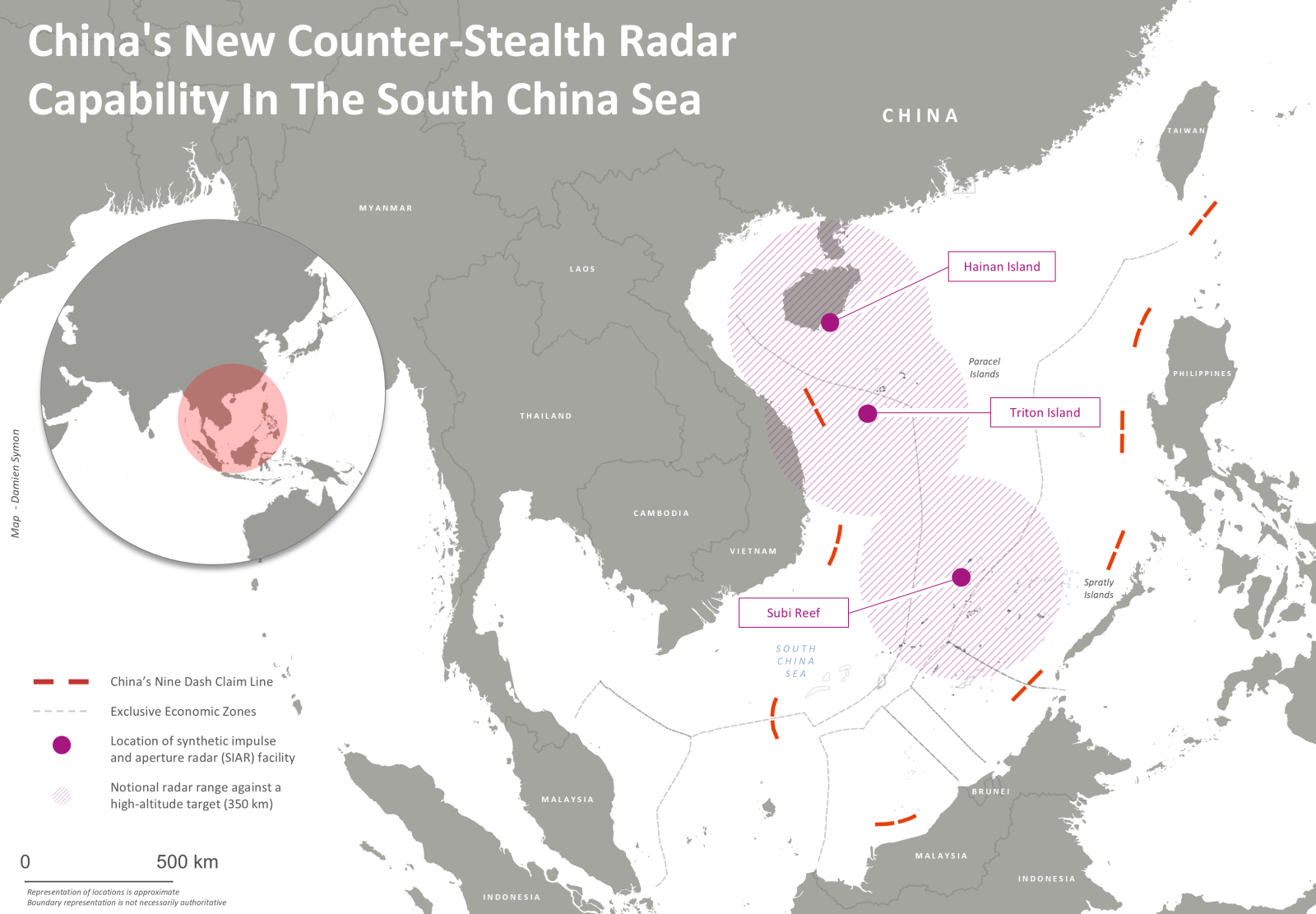
— Map credit: Damien Symon.
Overlapping anti-stealth network
A year after work was first identified on Triton, satellite images from Maxar have helped build a clearer picture of Beijing’s efforts to defend this strategic waterway.
The most striking development is the construction of a new radar system, known as SIAR – synthetic impulse and aperture radar – which purportedly detects stealth aircraft. The counter-stealth radar on Triton is characterized by its distinctive octagonal structure, which resembles another SIAR system built by China on Subi Reef in the Spratly Islands, south of the Paracels, in 2017. A half-completed tower also sits near the SIAR radar on Triton, which is likely to be the operations centre.
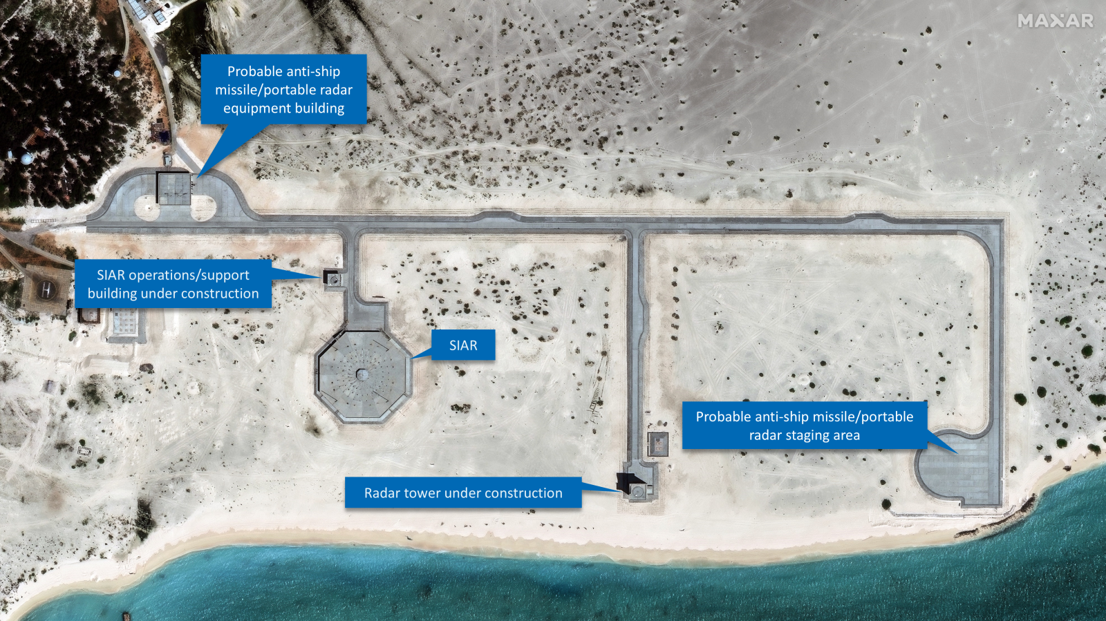
— Triton Island, September 2024: Satellite imagery disputes earlier assumptions that Beijing was building a 600-metre runway, revealing instead the development of a sophisticated counter-stealth radar system and a suspected launching point for an anti-ship missile battery.
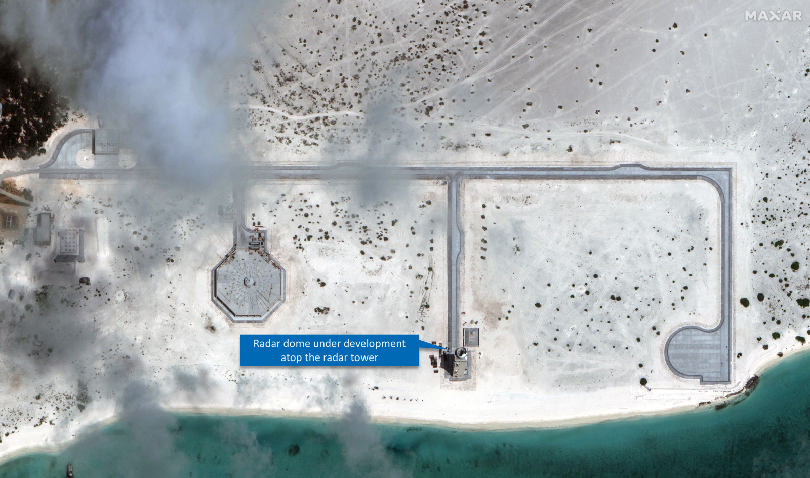
— Triton Island, October 2024: Developments continue on another radar tower, with a protective radome being built which will house the tower’s radar unit.
Once completed, the radar on Triton will form what is believed to be a wider network of at least three overlapping counter-stealth radars built across Chinese bases in the South China Sea over the past decade, including on Hainan Island, home to several Chinese naval bases.
The positioning of the radar on Triton, 320km south of Hainan, is telling, says J. Michael Dahm, Senior Resident Fellow for Aerospace and China Studies at the Mitchell Institute.
‘SIAR radars cannot see over the curve of the Earth, which means there is a gap in China’s air surveillance coverage between Subi Reef and Hainan Island. The Triton Island site will help close that gap’, said Dahm.
The aim, he suggests, is to give China contiguous counter-stealth radar coverage of the South China Sea.
More construction underway
The satellite images reveal other building projects on Triton. One is a large pad at the end of the road network which will probably be used as a launching point for a mobile anti-ship missile battery. The building at the northeast end of the road is probably a storage building for missile transport vehicles.
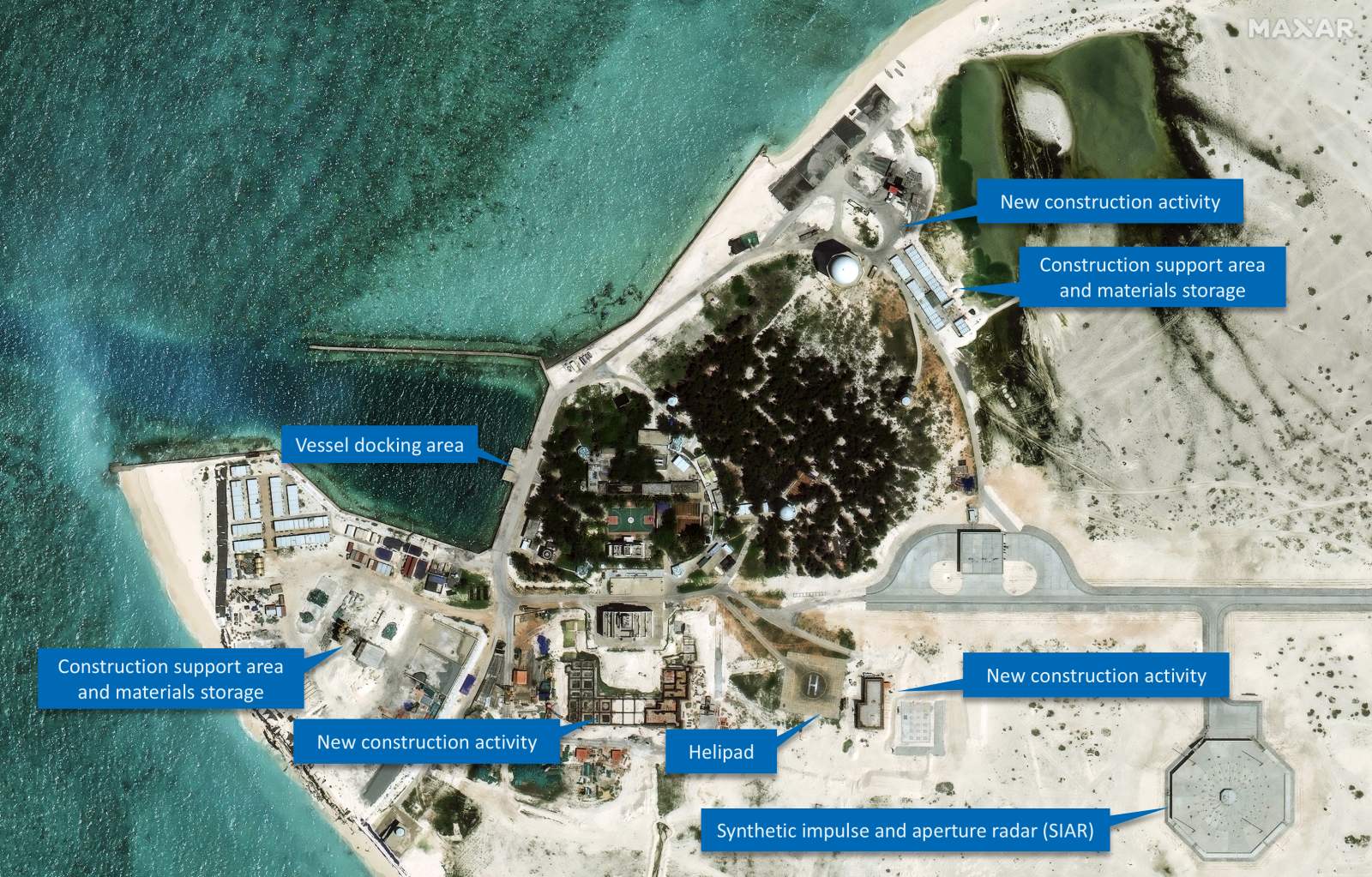
— Triton Island, September 2024: After rapid building work over the past year, Triton has become one of Beijing’s major intelligence hubs in the South China Sea, featuring new counter-stealth radar (SIAR) and suspected intercept signal buildings.
Diminishing Vietnam’s options
The development of a new counter-stealth radar system and other suspected signals intercept structures on Triton represents a notable increase in China’s intelligence capabilities in the Paracels. The Chinese Communist Party has not disclosed the purpose of the building work on Triton, but its effects on regional and global competitors are likely to be wide ranging.
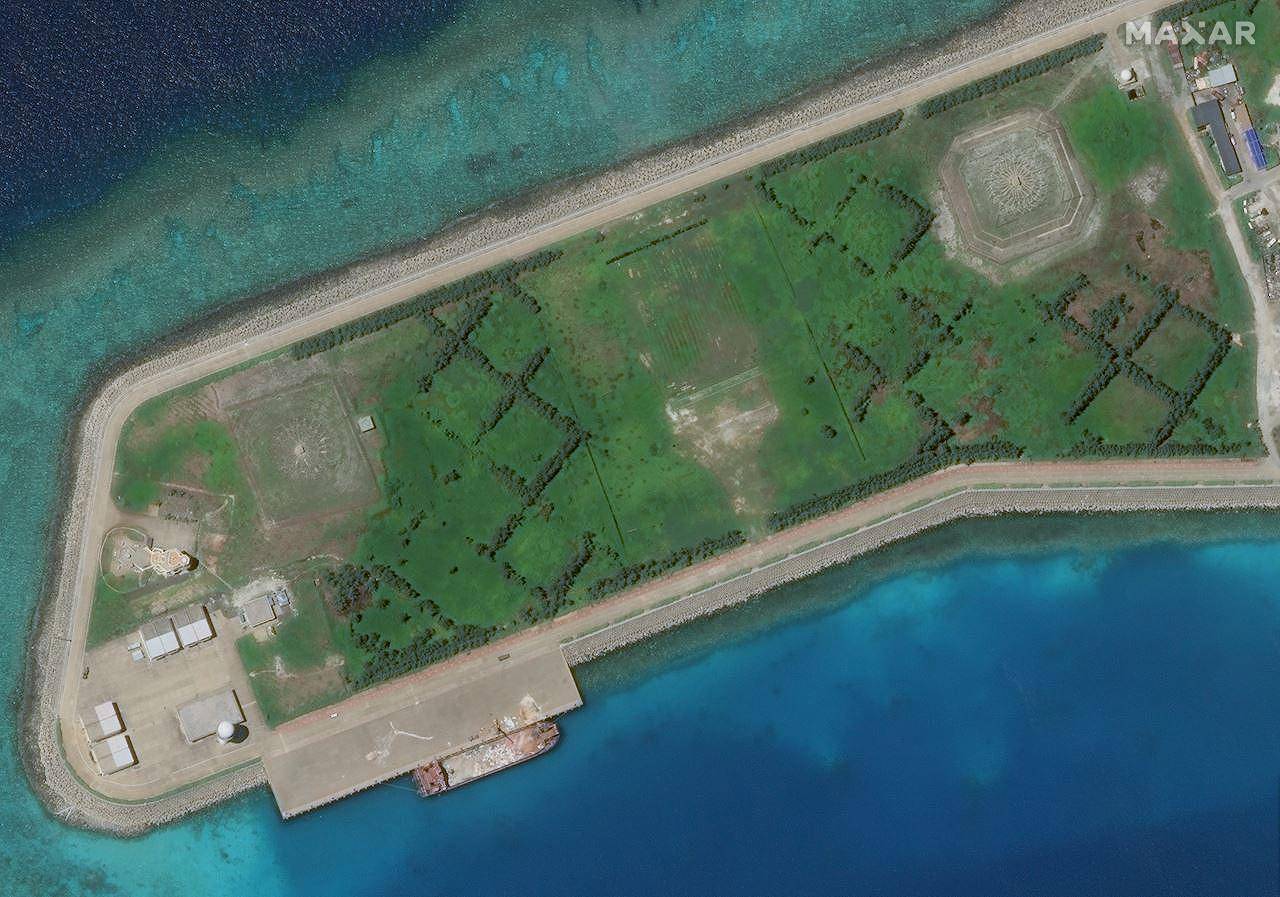
For Vietnam, which is rapidly expanding its own bases in the South China Sea, the intelligence structures on Triton would significantly diminish its capacity to operate undetected in the area. Alongside existing radar on Triton which can detect sea-going vessels, Beijing now has the potential to track Vietnamese air movements and gain forewarning of Hanoi’s manoeuvres in the area, including efforts to access oil and gas deposits.
The desire to strengthen control over these resources may explain why China is fortifying Triton Island, says Bill Hayton, Associate Fellow in the Asia-Pacific Programme, Chatham House. ‘The developments might be a warning that China is planning to mount another drilling expedition’, he suggests.
The facility may also impede attempts by the American, British and Australian navies to challenge China’s ‘nine-dash-line’ claim by navigating the waters of the Paracels. ‘The new facilities on Triton may be an attempt by China to make such operations more difficult in the future,’ Hayton adds.
On a strategic level, the expansion of Beijing’s counter-stealth radar network across the Paracels may help to erode the technological superiority that US and allied military forces have enjoyed in the region over the past three decades.
The EurAsian – After Philippines, China ‘Schemes’ To Encroach Vietnam’s Territory In Gulf Of Tonkin, Redraw New Baseline
China has officially disclosed a new baseline outlining its territorial claims in the northern part of the Gulf of Tonkin, an area shared with Vietnam.
The announcement, made through a statement on the foreign ministry’s website earlier this month, introduces seven base points that, when connected, form the baseline for Beijing’s sovereignty claims in the Gulf of Tonkin, known as Beibu Gulf in China.
The Gulf of Tonkin, situated off the coasts of Tonkin and South China, has been a historically significant point of maritime demarcation between China and Vietnam in the northwestern South China Sea.
In 2004, China and Vietnam reached a deal outlining the boundaries of their territorial sea, exclusive economic zone, and continental shelf in the Beibu Gulf.
Both sides saw the agreement as fair, marking China’s inaugural maritime boundary. Despite this agreement, maritime disputes persisted due to the remaining ambiguity regarding the boundary facing the sea.
Beijing has said that the lingering concerns would now be addressed through a fresh delimitation process. However, the timing and reasons behind China’s decision to introduce this baseline at this juncture remain unclear.
In an attempt to allay concerns, the Chinese Foreign Ministry asserted that the newly delineated baseline would not negatively impact Vietnam’s interests or those of any other nation.
Instead, they argued that it would foster international maritime cooperation between China and relevant countries and contribute to the overall development of the global maritime industry.
According to the Chinese Foreign Ministry, the announcement of the territorial sea baseline was an essential step in exercising national sovereignty and jurisdiction.
The statement also noted the existence of different management regulations and usage plans for internal waters, territorial seas, and exclusive economic zones, which emphasize the need for clearly defined baselines to facilitate the standardized and scientific use of the sea by coastal provinces and regions.
Further, the ministry contends that the delineation of the baseline for the northern part of the Beibu Gulf was integral to China’s broader efforts to improve territorial sea baseline delineation.
This move, according to Beijing, aimed to support the economic development of provinces and regions along the northern part of the Beibu Gulf, including Guangxi, Guangdong, and Hainan.
What Is Territorial Sea Baseline?
The territorial sea baseline serves as the foundation marker for coastal nations to establish their maritime jurisdiction claims and also signifies the outermost boundary of their national land territory.
According to the United Nations Convention on the Law of the Sea (UNCLOS), coastal states are entitled to a territorial sea width of 12 nautical miles (22.22 km), a 200-nautical mile exclusive economic zone (EEZ), and a continental shelf extending up to 350 nautical miles.
However, the Beibu Gulf, a semi-enclosed bay surrounded by mainland China, Vietnam, and China’s Hainan Island, has a maximum width of no more than 180 nautical miles.
This circumstance leads to a complete overlap of the exclusive economic zones and continental shelves of both countries within the Gulf, as outlined by the convention. Consequently, the entire Gulf is subject to overlapping claims by China and Vietnam.
The Chinese government had previously announced the geographical coordinates of some of its territorial sea baselines and points on two occasions.
The first announcement came in 1996, revealing the baseline of the inland territorial sea and the coordinates of 77 territorial sea points in the Xisha Islands. In 2012, China declared the baseline of the Diaoyu Islands and associated islets, along with the coordinates of 17 territorial sea points.
With this recent delineation, China has disclosed all its territorial sea baselines except for the portion adjacent to the Liaodong Peninsula in the Bohai Sea, as per the Chinese media. Incidentally, this third announcement also adds to the efforts to assert China’s maritime claims in South China.
Concerns Regarding The New Baseline
Vietnam and China inked a clear demarcation line agreement for the Gulf of Tonkin back in 2000, which should buffer any substantial blow to Vietnam’s economic interests from the fresh baseline, provided Beijing doesn’t push for renegotiation.
However, experts have flagged concerns about the distance of some base points from the coast, raising doubts about the new baseline’s compliance with UN maritime law and its potential to complicate various maritime activities.
Shashank S. Patel, a Geopolitical analyst closely monitoring activities in the Indo-Pacific, informed EurAsian Times, “Gulf of Tonkin/Beibu Gulf witnessed multiple boundary agreements between China and Vietnam in three decades from 1974 to 2004 devoting more than half of the waters to Vietnam. Declaring a new baseline seems excessive on the map which will further impact the EEZ and contagious zone of Vietnam providing major fishing zones to China.”
He said, “China’s new unilateral demarcation of the baseline is an attempt to limit Hanoi’s claims over their exclusive zones & to trim the high waters. China will get more access to the marine boundaries to tackle Western influence and assertiveness in tackling Southern part of the Gulf of Tonkin.”
“The new baseline will provide more than 60% water to Chinese authorities, a gross violation of UNCLOS in the territorial sea. May Vietnam will not escalate this issue at the highest levels but not doing so will impact its fishing rights, supply chains, and sea lanes in the coming days,” he added.
Patel also highlighted, “As China will not limit its misadventures in the South China Sea due to its ancient notion of controlling all the waters, the Gulf of Tonkin is one of the pins punched as per their self-centered verdicts.”
Additionally, the new baseline could hamper freedom of navigation, scientific research, cable and pipeline laying, and island reclamation efforts. Despite this, Hanoi has remained mum on China’s move.
Patel noted, “If Vietnam, on the lines of the Philippines, took the matter for arbitration, China would again reject the verdict, saying it illegal, null, and void. The matter of the fact is that the median line between China and Vietnam is being demarcated earlier, the second step of China will be to nullify it. It will give them more area of contention with Vietnam claiming exclusive economic zones in the Gulf of Tonkin.”
RFA – Japan to assist 4 ASEAN countries to counter China
The Japan International Cooperation Agency is preparing a 10-year maritime security support plan for four ASEAN nations – Indonesia, Malaysia, the Philippines and Vietnam – to boost security in the South China Sea, according to a media report.
The four countries are regarded as Tokyo’s top priorities in terms of security, public broadcaster NHK said, adding that the move is designed to counter China’s growing assertiveness in the disputed waters in the region.
The agency, known as JICA, is expected to unveil a detailed plan by March, 2025.
The support plan will see Japan providing drones, radar systems and patrol boats, as well as other capacity building measures to each of the four countries, according to NHK.
Japanese officials and specialists are believed to have conducted studies and on-site surveys last month in the Philippines and Indonesia. They are scheduled for April in Malaysia and Vietnam.
A JICA delegation led by Director General Hiroo Tanaka visited Manila in January to identify maritime security cooperation projects in the country.
During the visit of Japanese Prime Minister Fumio Kishida to the Philippines in November last year, Manila and Tokyo signed an agreement on Japan’s grant of coastal surveillance radars to the Philippines worth 600 million yen (US$4 million).
Japan’s ASEAN partners
“Japan will continue to invest in helping build capacities in Southeast Asian countries through the provision of vessels, capabilities and training,” Stephen Nagy, professor at the International Christian University (ICU) in Tokyo, told Radio Free Asia.
“Expect more in the future as Japan’s defense oriented self-defense approach and focus on the U.S.- Japan alliance means that Tokyo thinks it’s better to enhance the capabilities of each Southeast Asian states individually so they can have a stronger position in the South China Sea,” said Nagy, who also serves as the director of policy studies at the Yokosuka Council of Asia Pacific Studies.
In December 2023, ASEAN and Japan held a special summit to commemorate 50 years of friendship and bilateral cooperation. A major part of the event was dedicated to cooperation in maritime security.
On the sidelines of the summit, Kishida and his Malaysian counterpart Anwar Ibrahim signed a security assistance agreement worth 400 million yen (US$2.6 million) through which Tokyo will provide maritime equipment and rescue boats to Kuala Lumpur.
Malaysia-Japan bilateral relations were also upgraded to Comprehensive Strategic Partnership, the highest level of cooperation.
Separately, Japan and Indonesia also signed notes for the provision of a large Japan-built patrol vessel of up to 9.05 billion yen ($60.2 million) for the Indonesian Coast Guard .
Japan and Vietnam also elevated their bilateral relationship to a Comprehensive Strategic Partnership last year. Before that, in 2020, Tokyo agreed to a US$348 million loan agreement for Vietnam to build six maritime patrol vessels.
“Japan, who is by far the most trusted partner of many ASEAN member states, is stepping up in playing a security role in the region,” said Huong Le Thu, Asia deputy director at the International Crisis Group .
Japan has territorial disputes with China over the sovereignty of the Senkaku islands – known as Diaoyu by the Chinese – in the East China Sea.
China and four ASEAN countries – Brunei, Malaysia, the Philippines and Vietnam – hold contesting claims over parts of the South China Sea, but Beijing’s claim is by far the most expansive.
A U.N. tribunal in 2016 ruled against most of China’s claims in the South China Sea, but Beijing refused to accept the verdict.
Edited by Mike Firn and Elaine Chan.
Resolutions / Proclamations
THE HAWAII STATE LEGISLATURE CERTIFICATE
COMMEMORATING THE 50TH ANNIVERSARY OF THE INVASION OF VIETNAM’S PARACEL ISLANDS
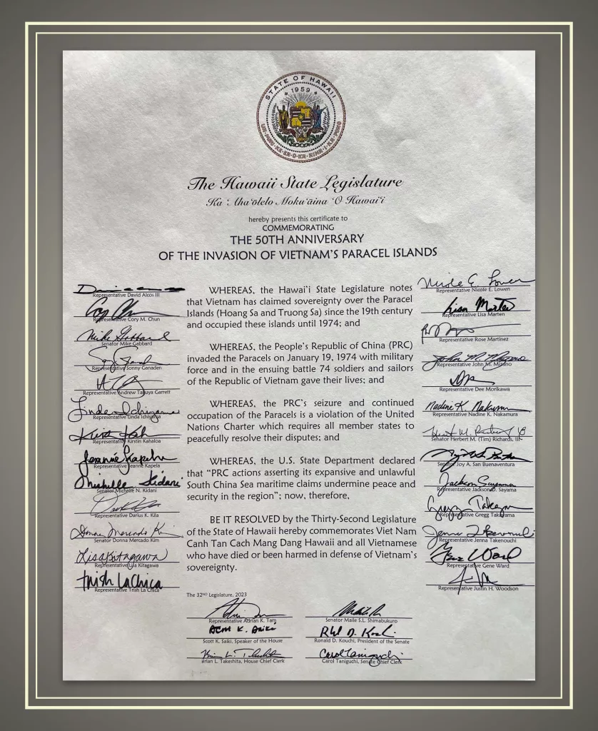
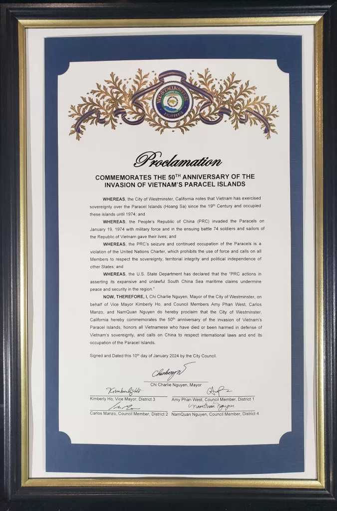
CITY OF WESTMINSTER, CALIFORNIA PROCLAMATION
COMMEMORATING THE 50TH ANNIVERSARY OF THE INVASION OF VIETNAM’S PARACEL ISLANDS
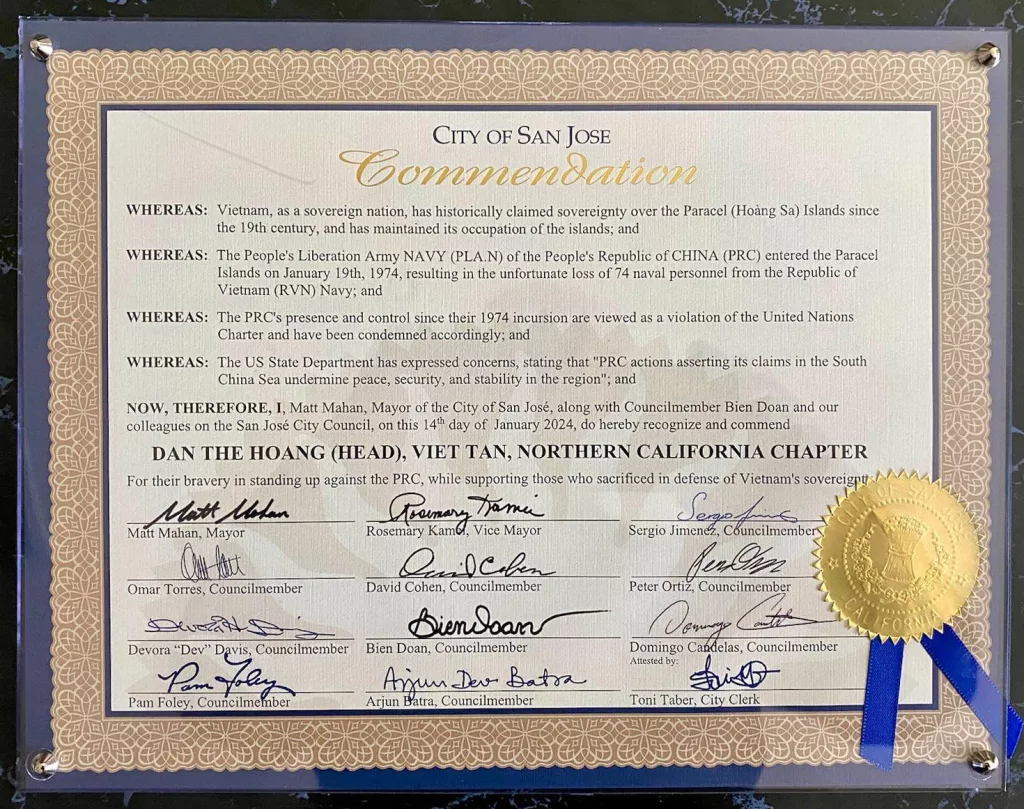
COMMENDATION BY CITY OF SAN JOSE, CALIFORNIA
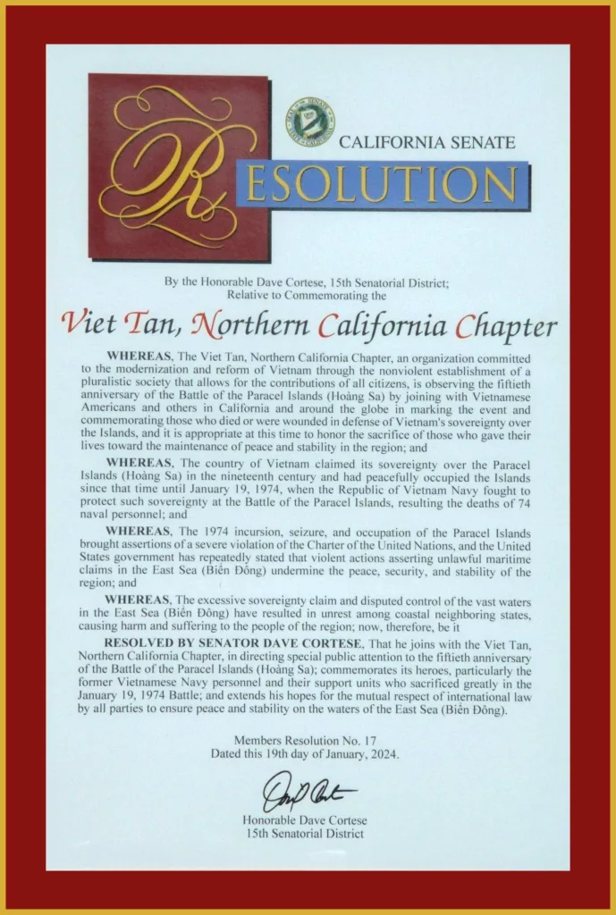
RESOLUTION BY SENATOR DAVE CORTESE – 15TH SENATORIAL DISTRICT, CALIFORNIA
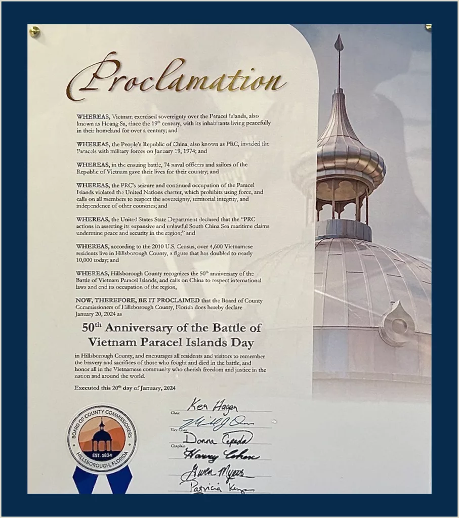
PROCLAMATION BY THE BOARD OF COUNTY COMMISSIONERS OF HILLSBOROUGH COUNTY, FLORIDA
50TH ANNIVERSARY OF THE BATTLE OF VIETNAM PARACEL ISLANDS DAY
Reuters – China military says Philippine ship ‘illegally entered’ waters near Scarborough Shoal
China’s military said on Monday that a Philippine military ship “illegally entered” waters near Scarborough Shoal without authorisation and it urged the Philippines to immediately stop its provocations.
The statement marks a rare warning from the Chinese military towards the Philippines over its moves in disputed waters in the South China Sea. The military had mostly directed its warnings against U.S. warships in the region.
China and the Philippines have had several confrontations in the South China Sea, recently trading accusations about a collision between a Chinese coastguard vessel and a boat from the Philippines.
“We are urging the Philippine side to immediately stop its infringement and provocations, and earnestly avoid further escalation,” said senior colonel Tian Junli, a spokesperson for the People’s Liberation Army Southern Theater Command.
The Scarborough Shoal is claimed by China, the Philippines and Taiwan.
“The Philippine side’s actions have seriously violated China’s sovereignty and international law and basic norms governing international relations, and are prone to misunderstanding and miscalculation,” Tian said.
He said China followed, monitored, warned and blocked the ship in accordance with the law.
Beijing claims sovereignty over almost the entire South China Sea, including parts of the exclusive economic zones of Brunei, Indonesia, Malaysia, the Philippines and Vietnam.
This has caused escalating maritime friction and territorial disputes.
NYT – Blasting Bullhorns and Water Cannons, Chinese Ships Wall Off the Sea
The Chinese military base on Mischief Reef, off the Philippine island of Palawan, loomed in front of our boat, obvious even in the predawn dark.
Radar domes, used for military surveillance, floated like nimbus clouds. Lights pointed to a runway made for fighter jets, backed by warehouses perfect for surface-to-air missiles. More than 900 miles from the Chinese mainland, in an area of the South China Sea that an international tribunal has unequivocally determined does not belong to China, cellphones pinged with a message: “Welcome to China.”
Read full article:
Blasting Bullhorns and Water Cannons, Chinese Ships Wall Off the Sea
RFA – Chinese Coast Guard water cannon attack on Vietnamese fishing boat leaves 2 injured
Chinese Coast Guard vessel CCG 4201 fired a water cannon at Vietnamese fishing boat near the Paracel Islands in the South China Sea
Two Vietnamese fishermen were injured when a Chinese Coast Guard vessel fired a water cannon at their boat near the contested Paracel Islands, the latest casualties in China’s aggressive campaign to expand its control in the South China Sea.
Tuesday’s incident, ahead of U.S. President Joe Biden’s visit to Vietnam on Sept. 10, happened as the fishing boat was moving from Woody Island to Observation Bank in the waters surrounding the Paracels, Vietnamese state media reported.
The ship’s owner, Huynh Van Hoanh, 43, suffered a broken right arm while fisherman Huynh Van Tien sustained a head injury during the attack by Coast Guard ship 4201.
The Paracel Islands, known as the Xisha Islands in Chinese and the Hoàng Sa Archipelago in Vietnamese, comprise about 130 small coral islands and reefs.
Claimed by China, Vietnam and Taiwan, they have been occupied entirely by Beijing since 1974 after the Chinese navy defeated the then-South Vietnamese navy in a brief sea battle. Triton is the closest island in the chain to Vietnam.
Researcher Nguyen The Phuong from the University of New South Wales in Canberra, Australia, said he expected to see more tensions between China and Vietnam in the South China Sea as the date of Biden’s trip approached.
Regardless of whether Vietnam and the U.S. upgrade their relationship to a “comprehensive strategic partnership” or “strategic partnership,” China will continue its maritime strategy of “rocking the tree to threaten the monkey,” he said.
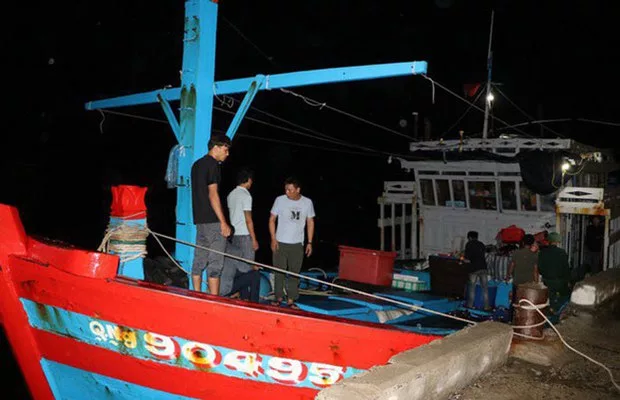
The Vietnamese fishing boat QNg 90495T is seen in port after it was attacked with a water cannon by Chinese Coast Guard vessel CCG 4201 near the Paracel Islands in the South China Sea, Aug. 29, 2023.
Marine Traffic data
Meanwhile, the same Chinese Coast Guard vessel and an unspecified Vietnamese boat, Ly Son 62908, have been chasing each other since Aug. 19 in the waters around Triton Island, where China recently built a 600-meter (2,000-foot) military airstrip.
China’s Coast Guard in recent years has ramped up its attacks on Vietnamese fishing boats by ramming them or firing water cannons to assert Beijing’s territorial claims in the resource-rich waters of the South China Sea.
The Coast Guard ship was operating in the middle of the Paracel Islands on the day of the attack, according to the automatic identification system, or AIS, data from maritime analytics provider Marine Traffic. The self-reporting system lets vessels broadcast their identification information, characteristics and destination.
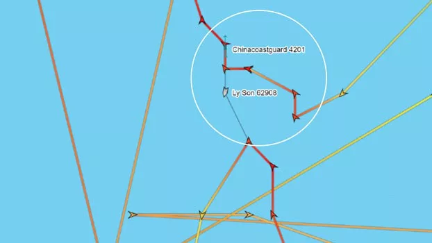
The Vietnamese boat Ly Son 62908 was once only 300 meters from the Chinese coast guard vessel CCG 4201 near Triton Island in the South China Sea, Aug. 25, 2023. Credit: MarineTraffic.com
Raymond Powell of the Gordian Knot Center for National Security Innovation at Stanford University and a former U.S. defense official, told Radio Free Asia that the position of the Coast Guard vessel coincided with the location of the attack reported by the fishing boat owner.
Marine Traffic data also indicated that the second Vietnamese ship had been moving around Triton Island. Since Aug. 19, the Coast Guard ship and Vietnam’s Ly Son 62908 have been following each other closely, and at one time were only 300 meters (1,000 feet) apart in distance.
On Aug. 27, the Chinese Coast Guard ship left the Triton Island area, headed northeast and arrived in the middle of the Paracel Islands, where it assaulted the other Vietnamese fishing boat, QNg 90495TS, two days later.
After the attack, the Coast Guard ship returned to the Triton Island area and continued the chasing game with Vietnam’s ship, Ly Son 62908. To date, the two ships are still following each other in the area.
Into the zone
Researcher Hoang Viet pointed out that China has intensified its aggressive actions since a phone conversation between U.S. President Joe Biden and Vietnamese General Secretary Nguyen Phu Trong in March and the visit to Vietnam by U.S. Secretary of State Antony Blinken in mid-April.
China had repeatedly sent its survey ship Xiang Yang Hong 10 into Vietnam’s exclusive economic zone, which extend 200 nautical miles (230 miles) beyond a nation’s territorial sea, he said.
Powell told RFA he believed it was a small militia vessel, and that the fishing boat had gone further east than the regular route of Vietnamese Coast Guard or militia ships. He also said although Vietnam claimed sovereignty over the Paracel Islands, it rarely sent security vessels to the middle of this archipelago.
“In fact, I’ve never seen them do that,” he said.
The attack on the fishing boat also followed an Aug. 5 incident in which a Chinese Coast Guard ship shot water cannons at a Philippine boat en route to providing food and supplies to Philippine forces on the Second Thomas Shoal.
RFA 01/09/2023
AP – China appears to be building an airstrip on a disputed South China Sea island
China appears to be constructing an airstrip on a disputed South China Sea island that is also claimed by Vietnam and Taiwan, according to satellite photos analyzed by The Associated Press.
The work on Triton island in the Paracel group mirrors construction on seven human-made islands in the Spratly group to the east which have been equipped with airstrips, docks and military systems, although it currently appears to be somewhat more modest in scale.
China claims virtually the entire South China Sea as its own, denying the claims of others and defying an international ruling invalidating its assertion.
Satellite photos from Planet Labs PBC analyzed by the AP show construction on the airstrip first visible in early August. The runway, as currently laid out, would be more than 600 meters (2,000 feet) in length, long enough to accommodate turboprop aircraft and drones, but not fighter jets or bombers.
Also visible are large numbers of vehicle tracks running across much of the island, along with what appear to be containers and construction equipment.
Triton is one of the major islands in the Paracel group, which is roughly equidistant from the coast of Vietnam and China’s island province of Hainan.
The U.S. takes no stance on the sovereignty claims, but regularly sends Navy ships on “freedom of navigation operations” near the Chinese-held islands. Triton was the focus of one of those missions in 2018.
China has had a small harbor and buildings on the island for years, along with a helipad and radar arrays. Two large fields on the island sport a star from the Chinese flag and a hammer and sickle representing the ruling Communist Party.
China has refused to provide details of its island construction work other than to say it is aimed at helping global navigation safety. It has rejected accusations that it is militarizing the crucial waterway, through which an estimated $5 trillion in trade passes annually, and says it has the right to do as it wishes in its sovereign territory.
China seized full control of the Paracels from Vietnam in a brief 1974 naval conflict.
AP 18/08/2023
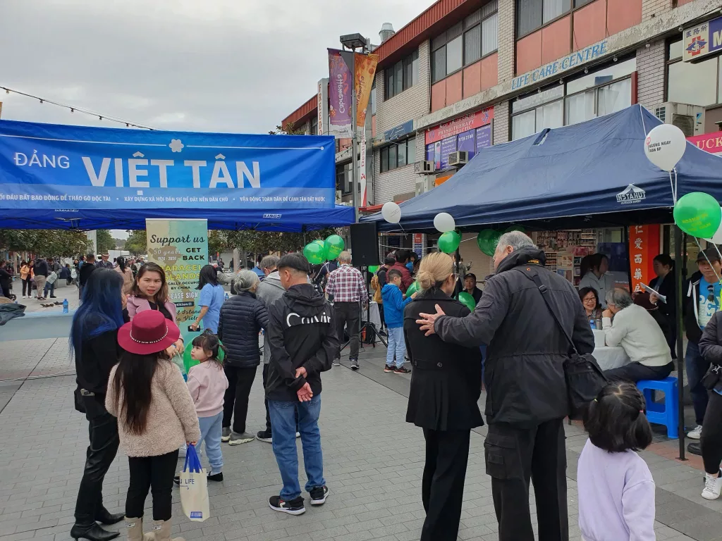
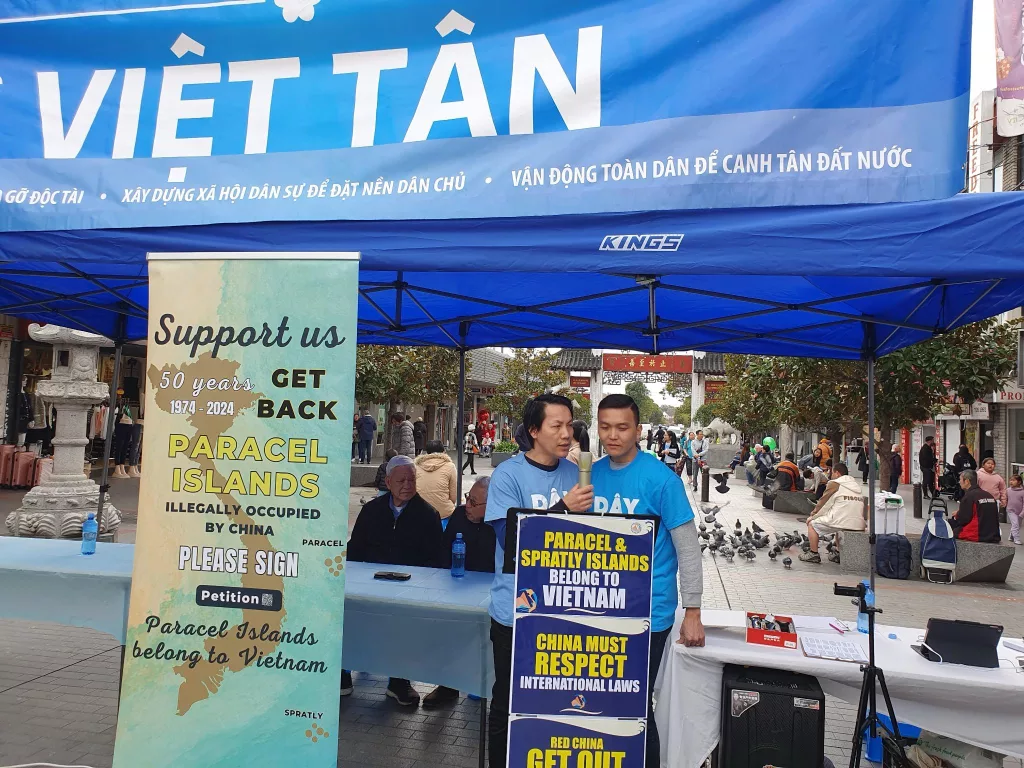
Sydney: Viet Tan members Mobilize to Collect Signatures for Paracel Islands Petition
The event drew attention not only from the local community but also from tourists, providing an opportunity for activists to explain the historical and legal evidence supporting Vietnam’s rightful claim to the Paracel Islands.
Their colorful banners and compelling messages drew attention, sparking discussions about justice, territorial sovereignty, and international law. The event concluded with an impressive number of signatures collected, showcasing the power of grassroots activism and inspiring similar initiatives worldwide.
In a significant move aimed at solidifying Vietnam’s territorial sovereignty, an international campaign has been launched to collect signatures for a petition urging prominent international institutions to officially recognize the Paracel Islands as an integral part of Vietnam. The initiative seeks to bring attention to the historical and legal evidence supporting Vietnam’s rightful claim to these islands in the South China Sea.
The campaign, spearheaded by Vietnamese activists and supported by various civic organizations, aims to gather a substantial number of signatures from individuals worldwide who share the belief that a fair and just resolution should be reached. The petition will be submitted to influential international institutions, such as the United Nations, Leaders of AUKUS and the Quad and Permanent Court of Arbitration.
The organizers of the initiative highlight the importance of upholding the principles of international law, particularly the United Nations Convention on the Law of the Sea (UNCLOS), which provides a framework for resolving maritime disputes. They emphasize that recognizing the Paracel Islands as Vietnamese territory would contribute to regional stability, promote peaceful negotiations, and safeguard the rights and interests of all parties involved.





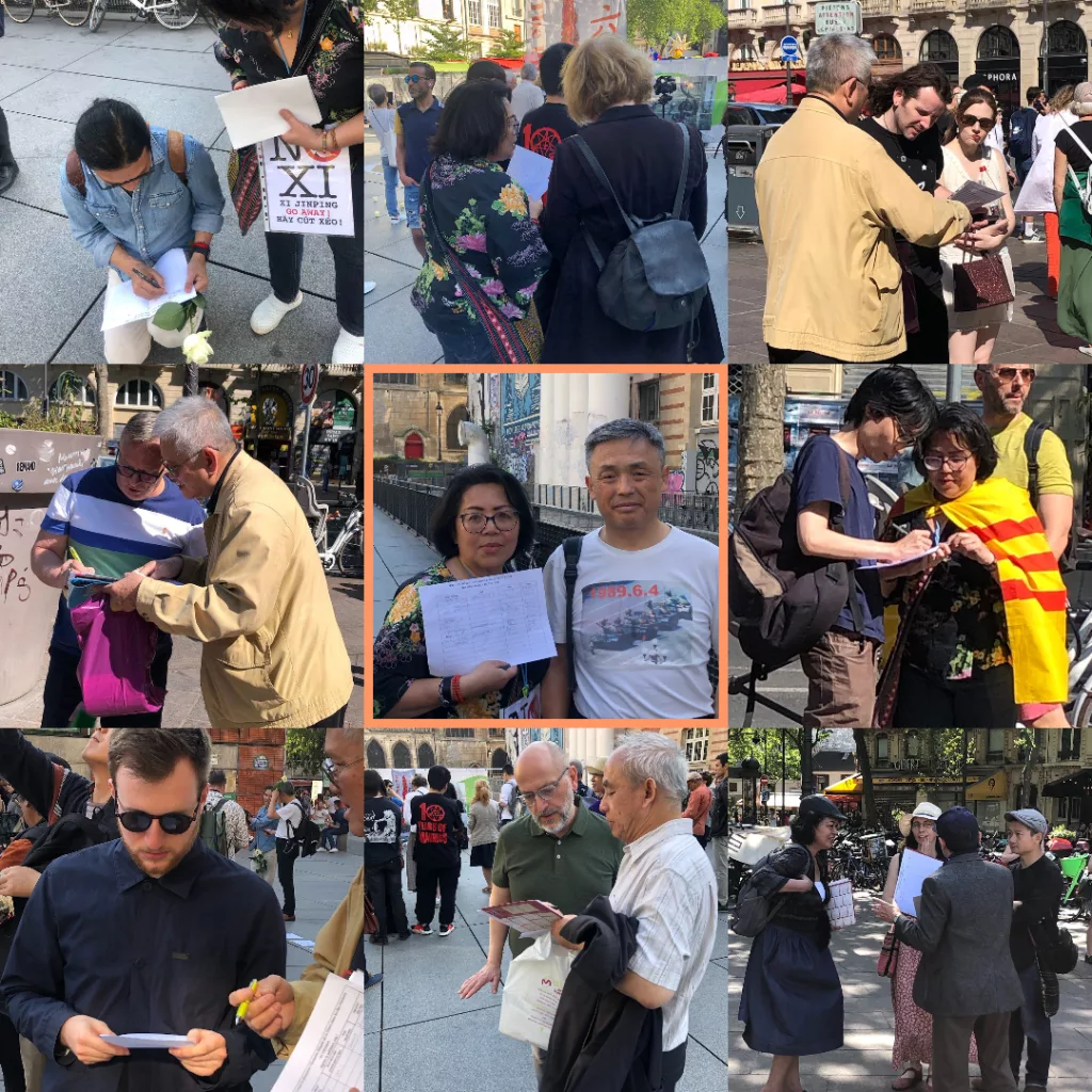
Activists Mobilize in Paris to Collect Signatures for Paracel Islands Petition
Passionate activists gathered in Paris, setting up booths and engaging with residents and tourists, to collect signatures for a petition urging international institutions to recognize the Paracel Islands as an integral part of Vietnam. Their colorful banners and compelling messages drew attention, sparking discussions about justice, territorial sovereignty, and international law. The event concluded with an impressive number of signatures collected, showcasing the power of grassroots activism and inspiring similar initiatives worldwide.


